This topic discusses the screen features that are common to both the Directional-Finding Graph and Map tabs. Use the Directional-Finding's Graph and Map tab to select the define the Acquisition values, Computation Parameters, and Receivers for your measurement.
This topic contains the following:
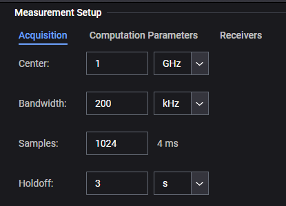
Acquisition- Displays the Center, Bandwidth, Number of Samples, and the Holdoff time. Refer to Acquisition.
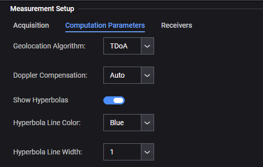
Computational Parameters -
Displays the Geolocation Algorithm being used for the current measurement.
Type of Doppler Compensation being used (Auto == Default), Off, On).
Current setting of the Show Hyperbolas line color (Default == On).
Hyperbola Line Color (Blue == Default), Orange, Yellow).
Hyperbola Line Width being used (1 (Default), 2, 3, 4)
Refer to Computation Parameters.
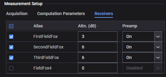
Receivers - Displays the current receivers available (Alias name) and selected and their Attenuation (dB) values and Preamp status.
Refer to Receivers.
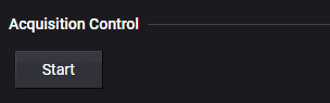
Acquisition Control contains the Start button to initiate the measurement.
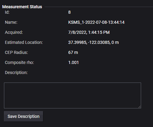
Displays the measurement's status details:
Id - Displays the measurement's number Id (e.g., "9" indicates the 9th measurement completed; 9 of 9).
Name - Displays the current measurement's name.
Acquired - Displays the date and time the measurement was completed.
Estimated Location - Displays the approximate latitude, longitude, and height of the current target.
CEP Radius - Displays the value of the circular error probability (CEP) radius
Composite rho - Displays the composite rho, indicating the measurement's quality (e.g., a composite rho value of 1.0 indicates that all of the transmitted power correlates with the ideal signal as determined by the detected sequence).
Description - Optionally enter a description for your current measurement to be saved with the measurement data.
Refer to Measurement Status Data.
Expanding and collapsing windows
You can expand and collapse (close) windows by clicking on the corner arrows.